Showing posts with label rock formations. Show all posts

Wednesday, August 26, 2020

Come Ride With Us

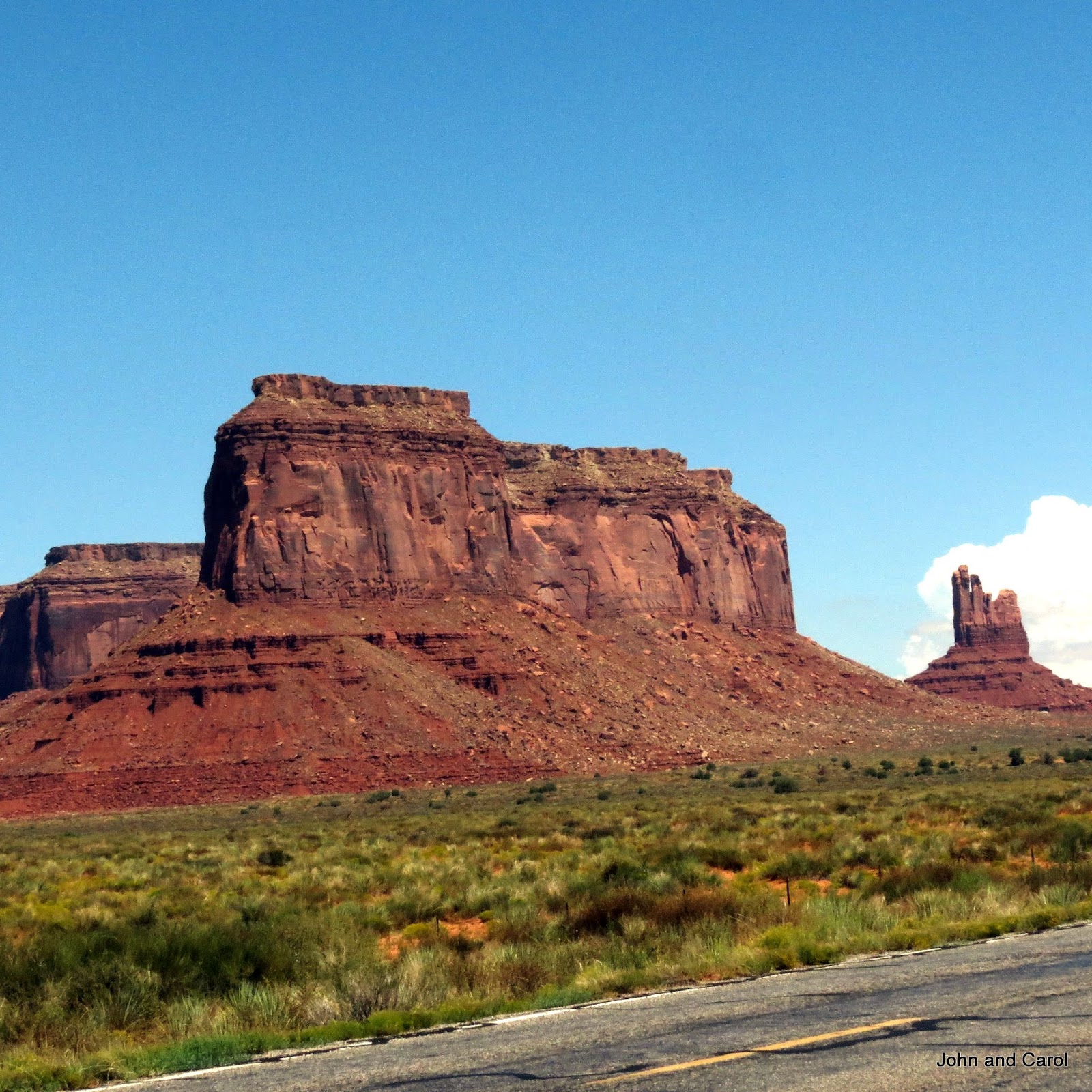
 Yesterday we drove from Moab to Torrey, Utah.  We had been exploring the area around Arches National Park and now we are in the Capitol Reef National Park area.  More and different rock formations.  Utah is amazing.

As we left Moag, we were surrounded by cliffs of red and pink stone.


Then, suddenly, there was this outcrop of pinkish white rock.


I would name the white formation below Table Mountain.  We passed signs with name for a number of the formations.  But I was busy looking at the scenery and taking photos and didn't keep track of what they are called.


Maybe this is a guard tower.


I thought this looked like a house on top of the mountain with a large overhanging roof to shade the people inside.


This is just a jumble of rocks.  It probably doesn't have a name.  I sure wouldn't want to hike up to the top.


I think this was called Ghost Mountain.  

And suddenly, we were surrounded by a forest of pinon pine and juniper trees.


We saw several signs warning we were in  open range and we frequently crossed cattle guards.  But this was the only cow we saw on the road.


I hope you enjoyed the scenery driving south from Moab to Torrey.  We plan lots of hiking in the next couple of weeks so I will be showing a lot more of the wonderful Utah scenery.

Wednesday, July 11, 2018

The Changing Scenery

Monday we left Blanding, headed to Flagstaff, Arizona, for a few days. For more than 2 weeks we have been amid the colorful rock formations in Utah. As we approached Flagstaff the scenery changed. It was a beautiful drive.

We drove through a narrow canyon for a short time.


On the other side we saw more rock formations. These looked like what we had been seeing.


But then the shape and color of the rock changed.  These two formations were thin layers of gray rock.


Then we passed more gray stone, but with more thickness.  A sign described this as church rock.


Then the vegetation and the rocks changed for a while.


These two towers weren't named as far as we could see.  Like we saw often along the road through the Navajo Indian Reservation, there were booths set up to sell the jewelry and other artistic works of the Navajos.


For a while it looked like we were driving on the moon.  I'm not impressed with this lunar landscape.


Finally, we cane to the mountains surrounding Flagstaff.


We will be here for a few days before heading to our house in very hot Gold Canyon to prepare to fly to England in less then 2 weeks.

Friday, August 28, 2015

Awesome Landscape

The Utah landscapes are really incredible. Yesterday we drove south, even spending a few minutes in Arizona. It's never boring around here. Several times an hour, the environment changed.


We drove through the town of Bluff. The sign on the way in says, "Established in 650 AD." Obviously, that date refers to the Ancestral Puebloans who lived here. Ruins of their villages are sprinkled all over the Four Corners area. In 1880, the first Mormon settlers came to the area to establish a farming community.

After Bluff, we came to Mexican Hat, another small town. This rock formation, which looks like an inverted sombrero, gave the community it's name.


As we approached Monument Valley, which extends into Arizona, we saw more distinctive rock formations.


We have been to Monument Valley twice before, in 1990 and 2005. We planned to drive through again. However, the road through the valley is now part of the Navajo Tribal Park and there is an entry fee. We didn't want to pay it since we had already been there. But just like our National Parks, the Navajo Nation has every right to charge people to explore their land.

There was more to this day. We visited Goosenecks State Park. But that will be covered in another post.

Wednesday, August 26, 2015

Canyonlands

The title could describe most of the territory in Utah, as well as northern Arizona. But I am talking about Canyonlands National Park. We visited the park during the summer of 2003, following our retirement in April of that year. We toured the Island in the Sky section of the park at that time. Here are two of the photos we took then.


This time, we are at the south end and hiked in the Needles section. The views are totally different. Instead of looking down, we were on the ground, looking up at the various rock formations. The 2.4- mile Slick Rock Trail was fun to hike and gave us great views. The first time we tried walking on slick rock, I was sure I would slide down as I tried to go up. I don't know why it is called slick when it isn't, but I have grown comfortable hiking in this terrain.


There are so many different colors of rock in the area, from yellow to red to pink to white.


In places, the canyon floor is covered with grass, providing a real contrast to the rock formations.


Here are even more of the rock formations we saw.


God has blessed Utah with so many beautiful, diverse geologic areas. We are so glad we have been able to spend time in the wonderful state this summer.